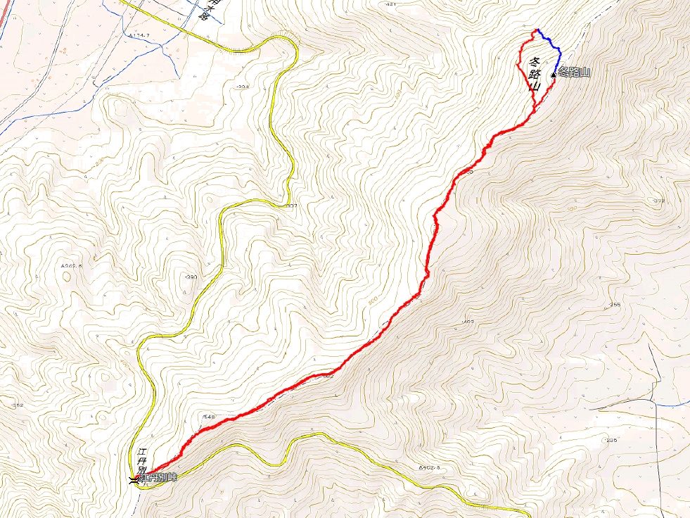
日時:2016/01/11 DIARY
start 09:40-11:44 冬路山 12:00-14:14 goal
駐車場所:江丹別峠の駐車スペース
Map of the route “冬路山”: 8,718 m, 569 m of climbing and 573 m of descent, elevation between 470 m and 639 m, time 04:25:51. It is a loop that starts and ends at 43.91959, 142.16660 (latitude, longitude).

コメント