日時:2017/01/08 DIARY
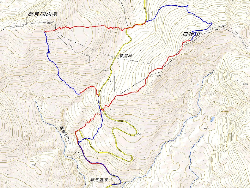
start 09:05-10:52 白樺山 11:10-13:02 前目国内岳 13:16-14:18 goal
駐車場所:新見温泉前の駐車スペース
Map of the route “白樺山&前目国内岳”: 10,131 m, 1,050 m of climbing and 1,038 m of descent, elevation between 477 m and 978 m, time 05:04:51. It is a loop that starts and ends at 42.88312, 140.54778 (latitude, longitude).


コメント